

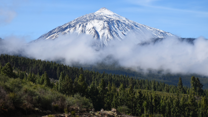

In 2023, a wildfire devastated an area covering 14000 hectares along Tenerife’s cumbre, spreading further down northern slopes than southern ones. Where it can be difficult to visualise a number, official maps made it abundantly clear how much of the island was affected.

Wildfires are, unfortunately, not uncommon in places with warm climates. We’ve witnessed plenty on Tenerife, one time seeing a whole section of forest near Erjos explode into flames. On another, we sat on our back terrace watching as flames spread across the Tigaiga Ridge. When we moved to Portugal, it was even worse. There was one year that it felt almost the whole country was on fire. The Portuguese have an app which alerts citizens if there are any fires nearby. Using it can be both terrifying and reassuring. Terrifying to see an alert for a fire that’s too close for comfort, reassuring to see the little fire icons change from active to extinguished.
On Tenerife, it often amazed us how quickly nature responded to fire damage. Within a couple of years, visitors probably wouldn’t be able to even spot where there’s been fire damage in some areas if they didn’t already know. That’s not the case with La Orotava Valley. Over three years later, parts of the upper valley are still like a disaster zone, and some hiking routes remain off limits. Additionally, some signs with ‘Prohibido pasar’ warnings and some without can make it unclear where hikers can walk or not. The Cabildo’s official site is quite useful for guidance about routes where there are restrictions. But it’s not detailed enough to confirm exactly where, or even if these are still in place . . . as we discovered when we investigated whether it was still possible to enjoy exploring paths in what is one of the best areas for hiking on Tenerife.

Walking routes from La Caldera
La Caldera above Aguamansa is an excellent base for walking in La Orotava. There’s a large car park, and a direct bus service from Puerto de la Cruz. There’s also a zona recreative (picnic zone) in the basin which gives the area its name. From the car park, trails snake east, west, north, and south. An information board details what these routes are . . . and has signs declaring some are out of bounds because of damage cause by the fire. These warning signs are a sight which must cause the hearts of hikers to sink. They did ours. We have three La Orotava trails in our self-guided hiking routes. At first, it looked like we’d have to pull all three. But we’re old hands when it comes to what the official line is and what’s reality. There are times when information simply hasn’t been updated.

Heading south east
The main pista (wide forest path) heads south east from the caldera. It’s an easy stroll for anyone with limited mobility who wants a taster of walking in the pine forest. Two of our routes initially head this way before veering off into meatier terrain. Signs clearly advise against walking it. However, after we saw a couple of Canarios and their dogs head along it with the confidence of people who knew the way ahead was clear, we decided to follow, but with caveats. If the path seemed remotely dangerous, we’d turn back. And if we encountered any forest rangers shouting at us for being there, we’d scarper as well.
One of the other things about venturing into a potentially dangerous area is understanding the landscape. For example, after heavy rains on Tenerife, there’s an increased danger of rockfall in some areas. There are no overhanging slopes or cliffs along the initial sections of the pista from La Caldera, so no danger of that. There was evidence of parts of the bank on the inland side having collapsed in areas, strewing some boulders across the wide path, but these were minor. The most surprising thing was that, despite maps showing this was one of the most severely affected areas, the surroundings didn’t look that much different from when we walked it prior to the fire. However, heading inland (south) was a definite no-no as that was where the heart of the damage was. As a result, we’ve had to dump the circuit passing Los Orgános for the time being.

Leaving the pista to descend north toward Aguamansa and the coast, we found no fire damage at all, meaning our shorter circuit was absolutely fine.
Heading south west
Trails to the south west of La Caldera aren’t as easy to find if you don’t know where they are. As there were no warning signs at the start of the one we include in our guide, we didn’t anticipate any problems with our Guanche Way circuit. Not for the first time, we found that official information and what we encountered on the ground didn’t quite match up. Maps suggest the fire didn’t impact this area to the same extent. Yet, there was far more evidence of fire damage over the first 1km than to the east. Not only that, the path was strewn with fallen trees. These required a few stepovers and occasionally made the way ahead unclear. But they shouldn’t pose too serious a problem for anyone who knows the terrain or is using detailed hiking directions. Beyond the first stretch, there was no further evidence of the forest fires, and we completed the 14km route without incident.

Summary
While the 2023 fire means parts of the Orotava Valley remain out of bounds for hikers, there are still plenty of options for exploring this beautiful part of Tenerife on foot, so long as care is taken and you don’t enter areas which may still be potentially dangerous.
We had to sideline one of the routes in our Northern Exposure set of self-guided hiking trails. But the other two in the upper Orotava Valley are still included, with slight amendments. Until it reopens, we’ve replaced the Los Órganos circuit with an enhanced coastal route, which we believe gives more of a contrast anyway.

One other point to consider. Despite the continued closure of some paths, La Caldera is still rammed with locals at weekends and fiesta days, so choose wisely if planning a visit.


Leave a reply