By now a lot of people will know that a huge Atlantic storm mixed things up a bit on the Canary Islands over the last few days.
The advisory information issued by the authorities before and during the storm meant that the islanders knew what was coming and were prepared for it when it arrived.
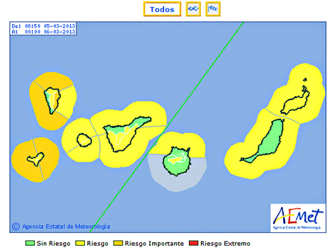
The storm was forecast to hit Tenerife on Sunday, affecting south, eastern and western parts before northern ones (thanks to the direction it was coming from). From Sunday through to the early hours of Tuesday morning, higher areas were going to experience wind gusts of hurricane strength whilst coastal areas expected gusts of anything between 70 and 100kph. Red, orange and yellow alerts were put in place for strong winds, wild seas, and rain (high ground and south, east and western coasts).
Although there are still weather alerts in place today, the storm panned out pretty much as advised… but not if you happened to be getting your information from some English language sources.
Pre Storm Denial
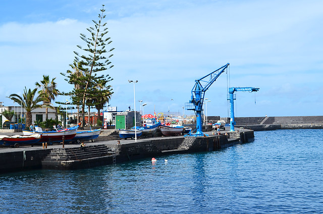
Saturday and even much of Sunday was hot and sunny in parts. On one travel advisory forum a member posted on Saturday that they thought the storm had passed during the night even though the alerts issued clearly stated that the storm wasn’t due to arrive till Sunday. Similarly there were premature comments on social media channels during Sunday morning that the storm hadn’t turned up.
On Saturday a friend had mentioned he was planning to walk to El Socorro on Sunday. We warned him about the storm but Saturday was such a lovely day that he couldn’t believe a storm was coming. The last we heard from him was a text on Sunday afternoon joking about ‘the bad weather’ as he basked in warm sunshine. That was just before an apocalyptic cloud blotted out the sun. There were no more texts after that. Thankfully he’s okay, apart from one bruised ego.
At a party on Saturday night we talked about the approaching storm. Everyone knew what the storm was going to consist of and that it was going to arrive from Sunday around midday. None of the other people at the party were British; subsequently their news sources were Spanish ones.
It’s Worse in the North
Whenever there’s bad weather affecting the south or south west of Tenerife there are always comments that end with ‘…but it’s worse in the north’ irrespective of whether it is or it isn’t.
I’m less touchy than I used to be about these as it’s just the way things are on Tenerife. But this time it was especially bizarre as no official Spanish sources suggested at any time that this was the case. In fact, quite the opposite. On the coasts, the alerts for wind and rain were higher for the south, east and western coasts than they were for the north. So the big question is why then say ‘but it’s worse in the north?’
We have a couple of theories.
The first is there seems to be a belief amongst some that the weather is always ‘worse’ in the north so it’s simply a given. Clearly this is nonsensical.
What’s more likely is a lack of understanding regarding what weather reports actually mean on Tenerife and about its geographical make-up. A few years ago on Tripadvisor the weather in the north was constantly being quoted as being at least 10 degrees lower than the south. The reason for this was that the south’s temperature readings were taken at Tenerife Sur airport on the coast, whilst the north’s were taken at Los Rodeos Airport in the hills where the temperature is significantly lower that the north coast.
People didn’t understand this and kept churning out the same misinformation.
Similarly, the highest level weather alerts are often for Vilaflor and La Orotava. This is where the mix up possibly comes in. When weather warnings mention La Orotava they don’t mean the town above Puerto de la Cruz, they mean the highest areas of the municipality, i.e. Mount Teide level.
During last year’s forest fires, it was reported that flames had reached the outskirts of the town of La Orotava. Whilst official reports did say the fire had reached La Orotava, they were actually referring to the municipality’s boundary at the crater wall way above the south coast.
Basically a lack of understanding of Tenerife led to serious misreporting.
Conflicting Reports
There were a number of components to this storm – wind, rain and wild seas. These components hit the island at various times with all three coinciding only now and again.
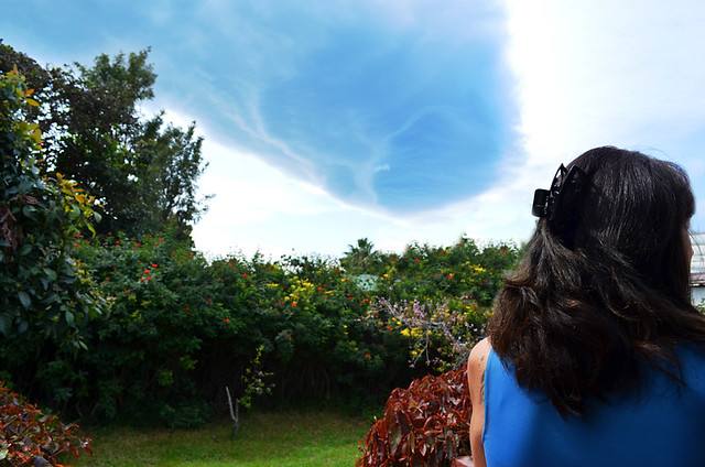
Although ferries struggled to berth in port; huge waves leapt over harbour defences; the cloud turned black and blotted out the landscape and the wind howled and blew trees onto cars, within the same municipalities there were reports about the ferocity of the storm at the same time as there were reports that the storm hadn’t arrived.
In Los Gigantes at least one person in the resort reported that things weren’t good whilst another commented that the storm hadn’t hit at all even though the Spanish press confirmed that nearby Guia de Isora was one of the areas affected the worst.
In reality the storm affected all of Tenerife but thankfully to a lesser extent than had been expected.
Information in English on Tenerife can sometimes be second and third hand, or even simply rumour. This is why yesterday, at exactly the same time as the government sent out an announcement in Spanish saying that the weather alert levels had been reduced, there were reports in English that the weather alerts had been raised to maximum level.
No wonder the weather on Tenerife, just like the sun that usually smiles on us here, will always be a hot topic.
Jack is co-owner, writer and photographer for BuzzTrips and the Real Tenerife series of travel websites plus lots of other things. Follow Jack on Google+



I was in Tenerife 26/213 to 05/03/13.
Having visited Los Gigantes on Saturday we were warned about the storm which was expected.
They were removing all boats from the harbour and taking them by lorries and trucks inland as waves of 17 feet were expected.
We were then unlucky enought to be in St Miguel on Sunday evening for a show when the storm hit. We had a power cut and the rain was so bad that it poured through the ceiling of the venue we were in.(We have never experienced it raining indoors before ha ha.)
This was quite an experience and having visited Tenerife yearly over the last 18 years, this last trip was very unusual.
Incredible. We don’t get them often but when we do they can be something else. The big question is – did the show go on?
We set sail from st Miguel on Sunday morning , hoping to reach shelter in to Santa Cruize before the storm hit – we experienced 58knots of Wind & 6m waves for a couple of hours before getting safely into port